There is something fascinating about Norse mythology. I am not yet sure if it is because of the complex characters, the deities, or the sagas that were written after the Viking Age. But one thing is certain – you cannot remain indifferent once you read them or listen to them. One of the stories, or rather symbols in Norse mythology, is called ''The Nine Worlds'', and it tells an interesting tale. There are various types of beings that can be found in these nine worlds, and they all represent some kind of world such as: the world of humanity, the world of ice, the world of fire...
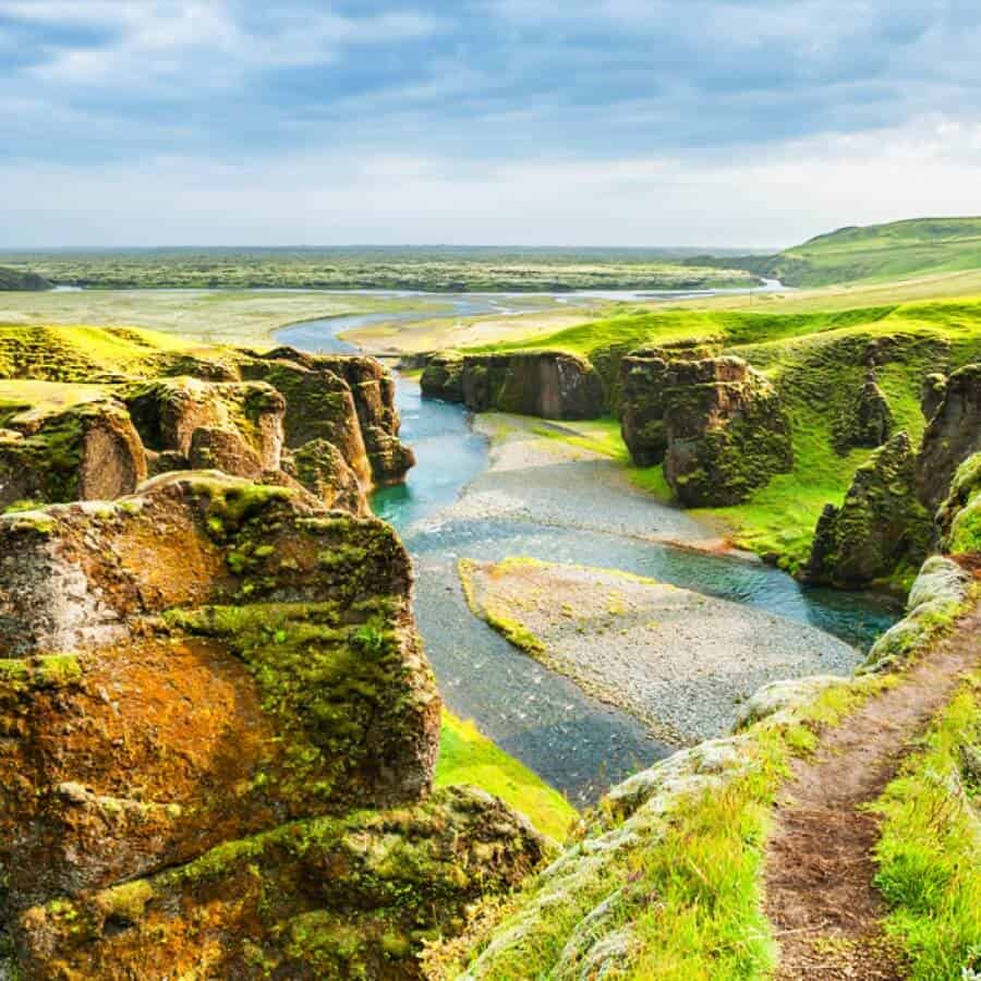
Now, if we speak about modern Icelandic tourism, we can note that there are a couple of interesting routes that are used for visiting different tourist attractions. When you take these routes, it almost feels like you are going from one world to another. Each location is somehow special, and different from the previous one. It is as though you jumped from Niflheim and the primordial world of ice to Muspelheim and the primordial world of fire. You can almost feel that Iceland is a magnificent world composed of many magnificent parts.
The Ring Road is the national road which circles the whole of Iceland. Its length is 1,332 kilometres, and the most popular tourist attractions lie along this it. In recent years this route has become very popular with foreign tourists who love to take it for their sightseeing and road trips. Seven days is the minimum for self-driving the ring road if you want to see all of the attractions that Iceland has to offer. Once you are outside of the city the traffic is non-existent, so it will be relatively easy to travel. The maximum speed on the most of the road is 90 kilometres per hour. The best way to start the trip is clockwise from the country’s capital, Reykjavík.
Another famous route is called Golden Circle. It is the 300 kilometre long route that loops from Reykjavík into the southern uplands of Iceland and all the way back. Some of the most famous tourist attractions are located on this road, including Þingvellir National Park, a geothermal area with two famous geysers – Geysir and Strokkur – and one of the most beautiful waterfalls in Iceland – the Gullfoss waterfall.
The Diamond Circle traverses a popular tourist route that goes from Húsavík to Lake Mývatn. This route covers important sights in North Iceland, and the stops that tourists like to make are in Húsavík and Vatnajökull National Park, Lake Mývatn. The Diamond Circle ends with the most powerful waterfall in Europe – Dettifoss Waterfall.
These three unique routes provide the possibility of exploring the entire island in a unique way by allowing you to experience adventures that will familiarize you with this breathtaking part of our planet. Most tourists arrive in the summer because of the weather, but the best prices and deals for tourists are in the fall and winter, and there is also a better chance to see Northern Lights in the fall. One thing is sure – regardless of the season, Iceland’s unspoiled wilderness, unique landscapes, and dramatic scenery will forever be stored in your memory. These are the things you will see if you decide to take these three circular roads:
Þingvellir National Park
This is the location where Iceland’s Parliament first met, back in 930 AD. It is also a place where you can see the boundary between the Euroasian and the North American tectonic plates. In 2004, Þingvellir National Park became a World Heritage Site because of its cultural, geological, and historical importance.
Silfra in Þingvellir National Park
The Silfra fissure is a special place on the world map because it is a crack between the Eurasian and the North American continents.The two continental plates move 2 centimeters every year, and the water here has astounding clarity. The average depth of the dive is between 7 and 12 meters, but you can dive all the way to 18 meters. Different types of algae and bright green ”troll hair” provide wonderful color in this world under the water.
Geysers at Haukadalur
The two famous geysers you can find here are called Geysir and Strokkur. They shoot water 18-30 meters into the air every 10 minutes, and this is one of the rare places in the world where you can see geysers erupt this predictably.
Gullfoss Waterfall
It is located on the river Hvítá, and the name can be translated as ”Golden Falls”. There are two separate waterfalls here. The lower one has a drop of 21 meters and the upper one is smaller, with a drop of 11 meters. Because of its strength, many plans for hydroelectric developments in this area have been discussed.
Kerið Crater Lake
This is a volcanic crater lake surrounded by red volcanic rock. With the nearly neon blue color of the water, it provides a stunning view. This is a fairly shallow lake (7-14 meters), and the property owners charge an entrance fee (around 3 Euro).
The Hvítá river and Skálholt
The Hvítá river flows for 40 km and then drops into a gorge at the Gullfoss waterfall. This is one of the most dangerous rivers in Iceland, but it is also the place where many rafting excursions take place at different points along the river. Skálholt is one of the most important places in all of Iceland from an historical point of view. The first Icelandic school was founded at Skálholt in 1056, and the cathedral that is the trademark of this place was built between 1956 and 1963.
Friðheimar farm
If you want to take a meal in a greenhouse surrounded by plants in a charming setting, Friðheimar farm is the right place for you. This is a vegetable farm where the main product is tomatoes, which are grown using energy and organic pesticides. Fresh-baked bread and tomato soup could prove to be a great choice.
Laugarvatn Fontana Spa
Fontala is located right by Lake Laugarvatn. The spa offers warm geothermal pools and natural steam rooms. There are saunas and pools of different temperatures that you can choose from. It has been used for this purpose since 1929.
Jökulsárlón Glacier Lagoon
This glacial lake is one of the greatest wonders of nature in Iceland, and there are many large icebergs that float on the lagoon. A depth of 250 meters makes it the deepest lake in Iceland. Hollywood movies such as Batman Begins and Lara Croft: Tomb Raider have used this setting for their scenes.
Seljalandsfoss and Skógafoss waterfalls, Dyrhólaey, and Reynisfjara beach
Seljalandsfoss is one of the highest waterfalls in Iceland, with the height of 63 meters. This is one of those rare places where you can walk right up to a waterfall and then behind it. Skógafoss is another high waterfall with a width of 25 and a drop of 60 meters. Dyrhólaey is a small peninsula which rises 120 meters above the water. Reynisfjara is a beach covered with volcanic stones and has black sand.
Vatnajökull glacier
This is the the largest ice cap in Iceland and Europe, covering 8 per cent of the country. There are several volcanos in this area, and the average thickness of the ice here is 400 meters. One of the most popular TV series – Game of Thrones – was filmed in this location.
Dettifoss waterfall
Detiffoss is the most powerful waterfall in Europe. It is 100 meters wide and has a drop of 44 meters. It was an inspiration for the musical composition ”Dettifoss” by Jón Leifs and shots of this waterfall can be seen in the movie Prometheus.
Mývatn
The lake is situated in an area of active volcanism and is fairly shallow. This lake is an important area for birding, and it is exceptionally rich with fauna of waterbirds. There are thirteen species of ducks which nest here.
Blue Lagoon
The Blue Lagoon is the most popular destination in Iceland for foreign tourists, and it is widely known because it is often featured in the world media. It is located around 50 minutes from Reykjavík. The water is rich with sulfur and minerals, and it is a place that can help people who are suffering from skin diseases. There is a strict code of hygiene, and guests have to take a shower before they enter the Blue Lagoon.
Þjórsárdalur Valley
The area of Þjórsárdals is lush with vegetation. There are many species of moss, grass, and angelica, especially in the spring. The landmarks that can be seen in this valley are Þjóðveldisbærinn Stöng, Háifoss, Gjáin, and Vegghamrar.
Sólheimasandur Plane Crash
A US Navy DC 3 ran out of fuel in 1973 and crashed here. Fortunately, no one died. This place became a heaven for photographers because it provides wonderful scenery as a backdrop to the abandoned DC 3, black sand, and the surrounding landscape.
Photo: Shutterstock
Support us!
All your donations will be used to pay the magazine’s journalists and to support the ongoing costs of maintaining the site.
Share this post
Interested in co-operating with us?
We are open to co-operation from writers and businesses alike. You can reach us on our email at [email protected]/[email protected] and we will get back to you as quick as we can.


